Roadtrip Through Southern Iceland
Our trip to Iceland didn't exactly start as planned. Two days before we were meant to fly to Reykjavik, we checked our flight info online to see when we could check in. To our surprise, the WOW Air website simply had a message stating that the airline had gone out of business and all flights were cancelled. This meant having to book new flights (which were about 3x the original price since everyone flying with WOW was now frantically re-booking with Iceland Air) and submitting a claim through the credit card company, hoping to get a refund for the original flights.
Thankfully, this is where the bad news ended. We flew into Reykjavik overnight from London Luton and hired a car from the airport. Our little white Hyundai i10 (which we nicknamed Tiny) was full of information about driving in Iceland and Budget even threw in a free wifi dongle. Iceland wants to ensure you are over prepared for driving in their country and you are bombarded with videos on the Iceland Air flights, information from the car rental companies and brochures telling you what to do, not to do, and how to be safe.
We headed off in Tiny toward the Golden Circle. With one day removed from our itinerary because of the flight issues, we were now trying to fit 5 days of planning into 4 days of time.
DAY 1: KEF Airport-Golden Circle- Vik
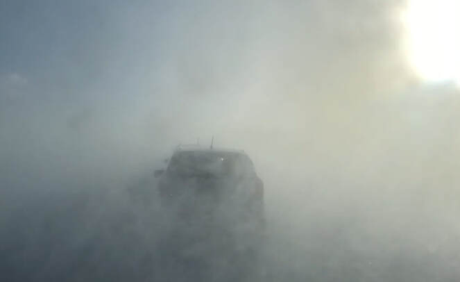
Less than an hour into the drive, somewhere between Mosfellsdalur and Þingvellir National Park, the clear blue skies quickly changed to a complete whiteout. The winds were blowing and poor Tiny was barely staying on the road. There are (thankfully!) little yellow guideposts along most of the roads in Iceland and these became integral for us being able to inch forward in the snow. We were driving about 2km per hour and could barely see the car that was about 5 feet in front of us. Several times the line of cars creeping forward in this storm would stop completely. This must be a pretty regular occurrence, as we were warned the weather could turn quickly and nobody else seemed too phased (meanwhile our car was not so calm). We decided that we didn't want to die within the first hour in Iceland so we found a spot to turn around and went back the way we had come. And just like that, the sky cleared and we were back on beautiful clear highway with the sun shining.
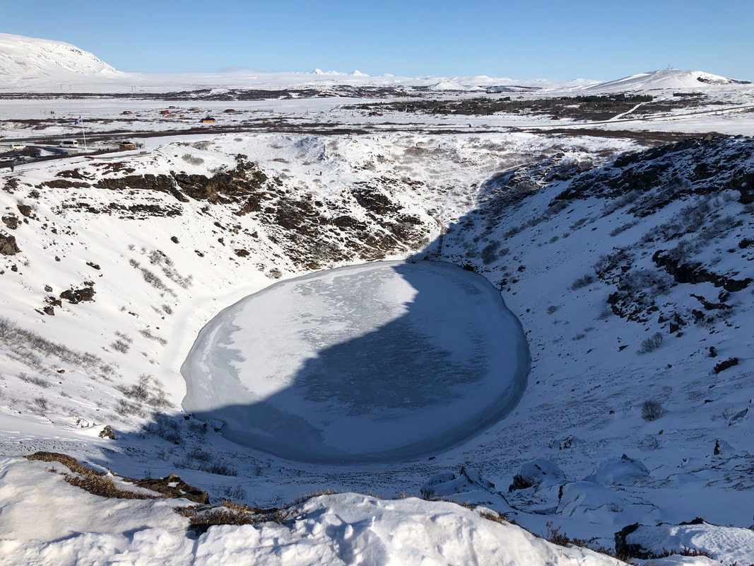
Approaching this time from the southwest, we found our way to Kerid Crater. Since the temperature was still quite cold, the lake was frozen but the perfect circle of the crater was still perfectly visible. At approximately 3,000 years old, the crater is only half the age of most the other surrounding volcanic features.
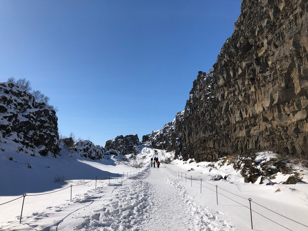
We decided to give Þingvellir National Park one final attempt, this time driving in from the south. We managed to avoid the main highway to the north that gave us issues earlier, parked the car and walked from Öxarárfoss through to the main site and visitor centre. As you walk along the rift valley, between the walls of North America and Eurasia, you can see why scenes of Game of Thrones were filmed there.
We decided to give Þingvellir National Park one final attempt, this time driving in from the south. We managed to avoid the main highway to the north that gave us issues earlier, parked the car and walked from Öxarárfoss through to the main site and visitor centre. As you walk along the rift valley, between the walls of North America and Eurasia, you can see why scenes of Game of Thrones were filmed there.
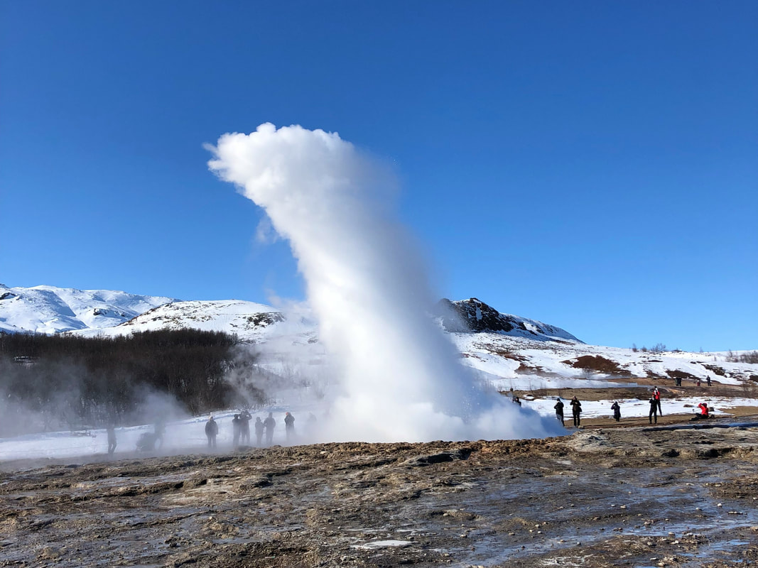
Next we headed to the Geysir Geothermal Area to watch the Strokkur geyser erupt and spray into the air. Luckily the geyser is very active and erupts every few minutes, so you don't have to wait long. There are several other hot springs and geysers in the area around Strokkur, but they are currently inactive.
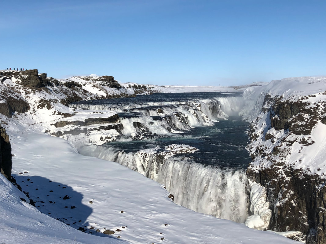
The final stop on the Golden Circle was Gullfoss Waterfall. The view was incredible, but the wind was fierce and the cold was cutting near the edge of the platform. The viewing platforms are located above the falls, so the water seems to disappear down a large crack in the earth below.
The final stop on the Golden Circle was Gullfoss Waterfall. The view was incredible, but the wind was fierce and the cold was cutting near the edge of the platform. The viewing platforms are located above the falls, so the water seems to disappear down a large crack in the earth below.
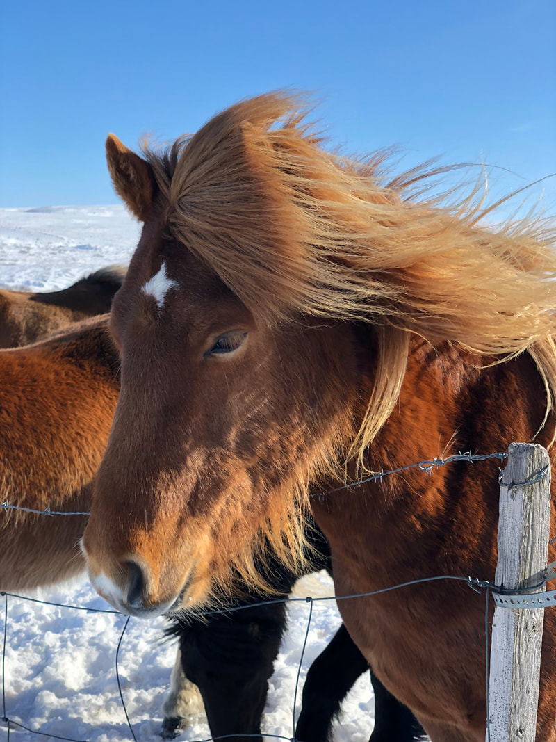
This was meant to be the end of our Day 1 adventures, but with one day lost we needed to kept moving to Vik. Luckily, shortly after leaving Gullfoss, we discovered the magical Icelandic horses. These horses are the only kind of horse found on Iceland and are small and shaggy. They are incredibly beautiful and are the only horses in the world with 5 gaits (ways of walking). No other type of horse are allowed in Iceland, so these horses have been purebred for over 1000 years. If an Icelandic horse leaves Iceland, it isn't allowed to come back.
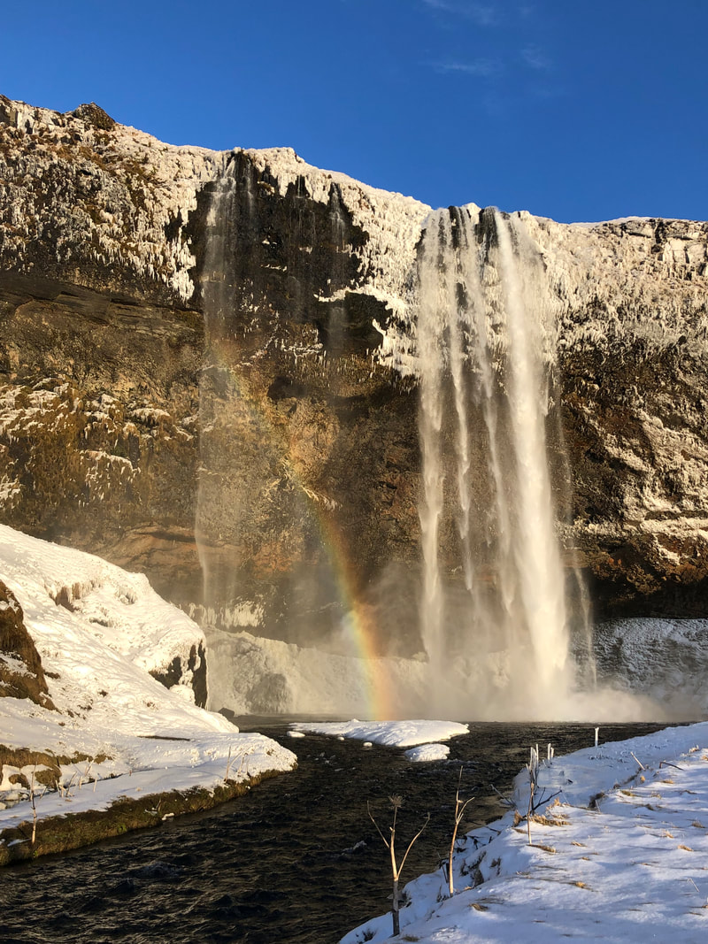
Our next stop was another waterfall called Seljalandsfoss, with a drop of 60 meters. In the warmer months, you can walk fully around the base of the waterfall and see it from behind the falls, but the weather was still a bit cold and the paths were slippery. The sun was starting to go down and we got to see a rainbow right next to the falls. There is another waterfall in the nearby area- Gljúfrafoss is just 700 meters down the same path, where you can walk into a small canyon.
Our next stop was another waterfall called Seljalandsfoss, with a drop of 60 meters. In the warmer months, you can walk fully around the base of the waterfall and see it from behind the falls, but the weather was still a bit cold and the paths were slippery. The sun was starting to go down and we got to see a rainbow right next to the falls. There is another waterfall in the nearby area- Gljúfrafoss is just 700 meters down the same path, where you can walk into a small canyon.
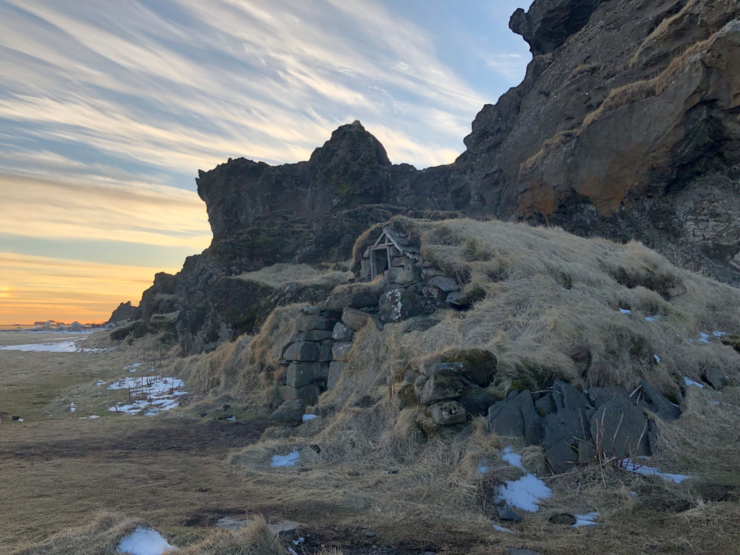
A short 20 minute drive further toward Vik, there is a large rock sitting in the middle of a field. This is the site of Drangurinn Rock in Drangshlíð. Here there are a series osf turf buildings built into the base of the rock. The caves beneath the rock are said to be home to elves and according to myths the elves would help care for cows that gave birth overnight- but only if humans did not interfere.
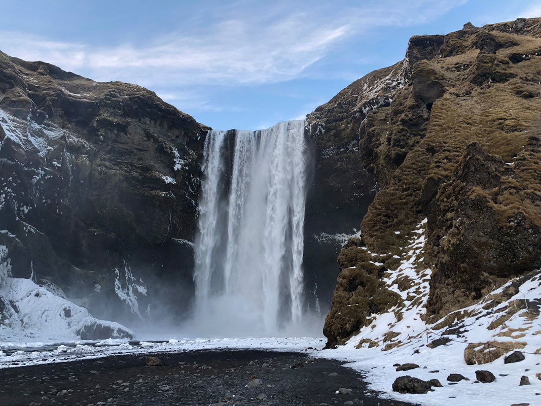
A short 5 minute drive to Skógafoss rewarded us with one of the more spectacular waterfalls we saw in Iceland. The falls are also 60 meters high, but their 25 meter width makes them seem even more fantastic. The water falls into an amphitheater-like rock basin and the water mists up around you as it hits the bottom.
A short 5 minute drive to Skógafoss rewarded us with one of the more spectacular waterfalls we saw in Iceland. The falls are also 60 meters high, but their 25 meter width makes them seem even more fantastic. The water falls into an amphitheater-like rock basin and the water mists up around you as it hits the bottom.
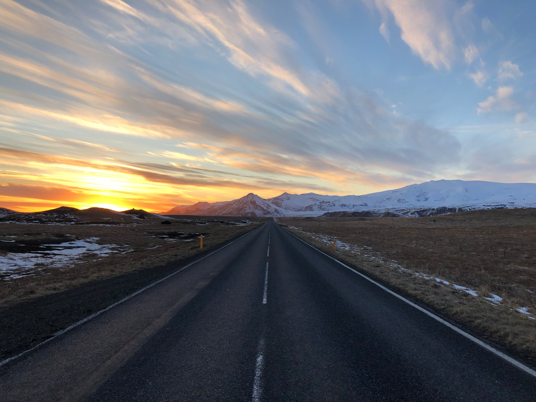
Having almost made it to our end destination for Day 1, we stopped to enjoy the sunset over the Black Sand Beach just outside of Vik. The colours were beautiful as they spilled over the long, flat highway behind us and the black sand in front of us.
After covering nearly 400km on very little sleep, we pulled into The Barn Hostel in Vik, the most southern village in Iceland, just after dark. We might have just been really tired, but the bunks in the shared dorms were incredibly comfortable and our hostel pasta dinner tasted amazing.
After covering nearly 400km on very little sleep, we pulled into The Barn Hostel in Vik, the most southern village in Iceland, just after dark. We might have just been really tired, but the bunks in the shared dorms were incredibly comfortable and our hostel pasta dinner tasted amazing.
DAY 2: Vik-Hofn
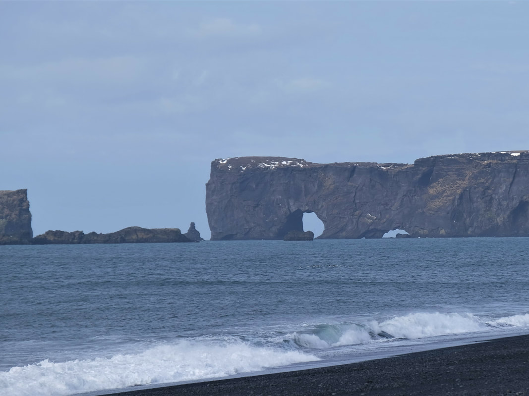
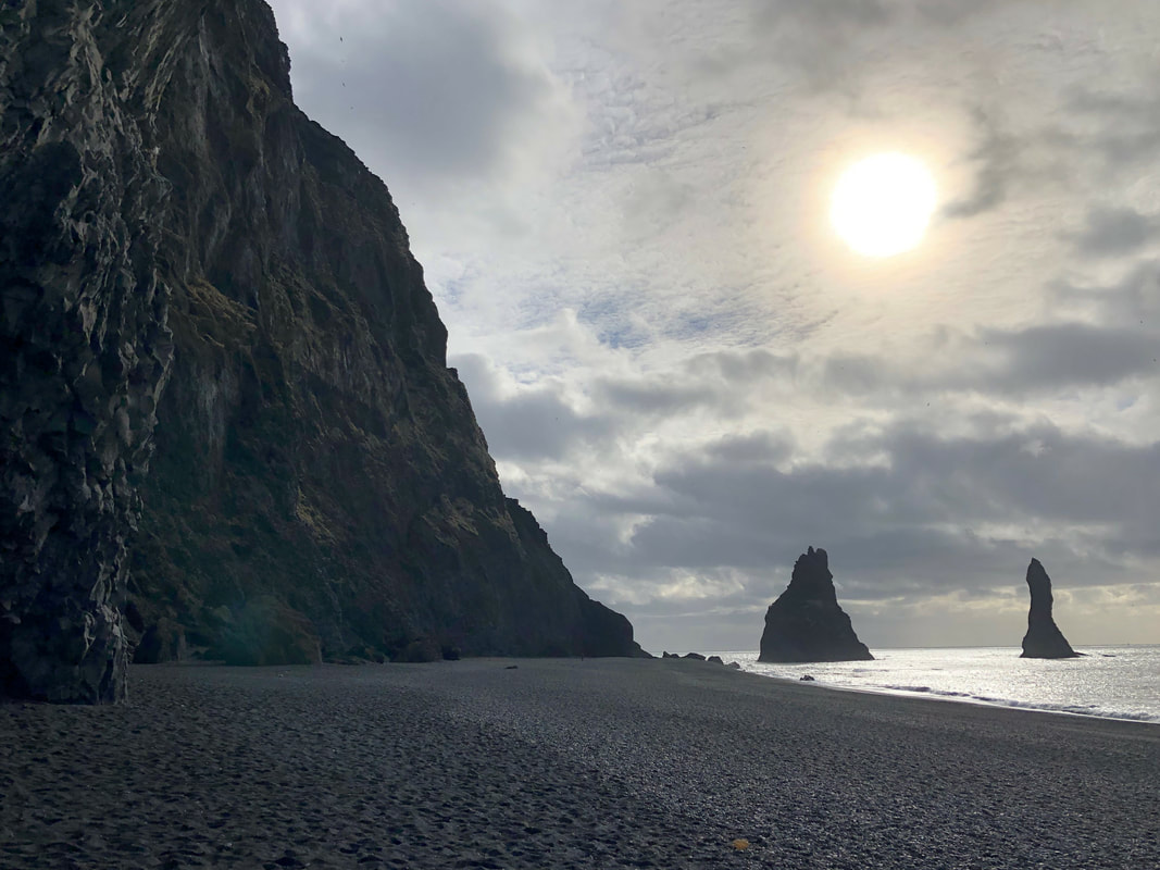
Feeling fresh after a full night's sleep, we started off in the morning to cover the 300kms from Vik to Hofn. Our first stop was actually backtracking 20km to Dyrhólaey Peninsula. After a short walk, you are rewarded with an incredible coastline view on both side. To the right you can see the rock arch and to the left you can see the finger-like rocks of Reynisdrangar sticking out of the water near Vik's black sand beach. According to folklore, the rock formations are said to be trolls that were frozen to stone.
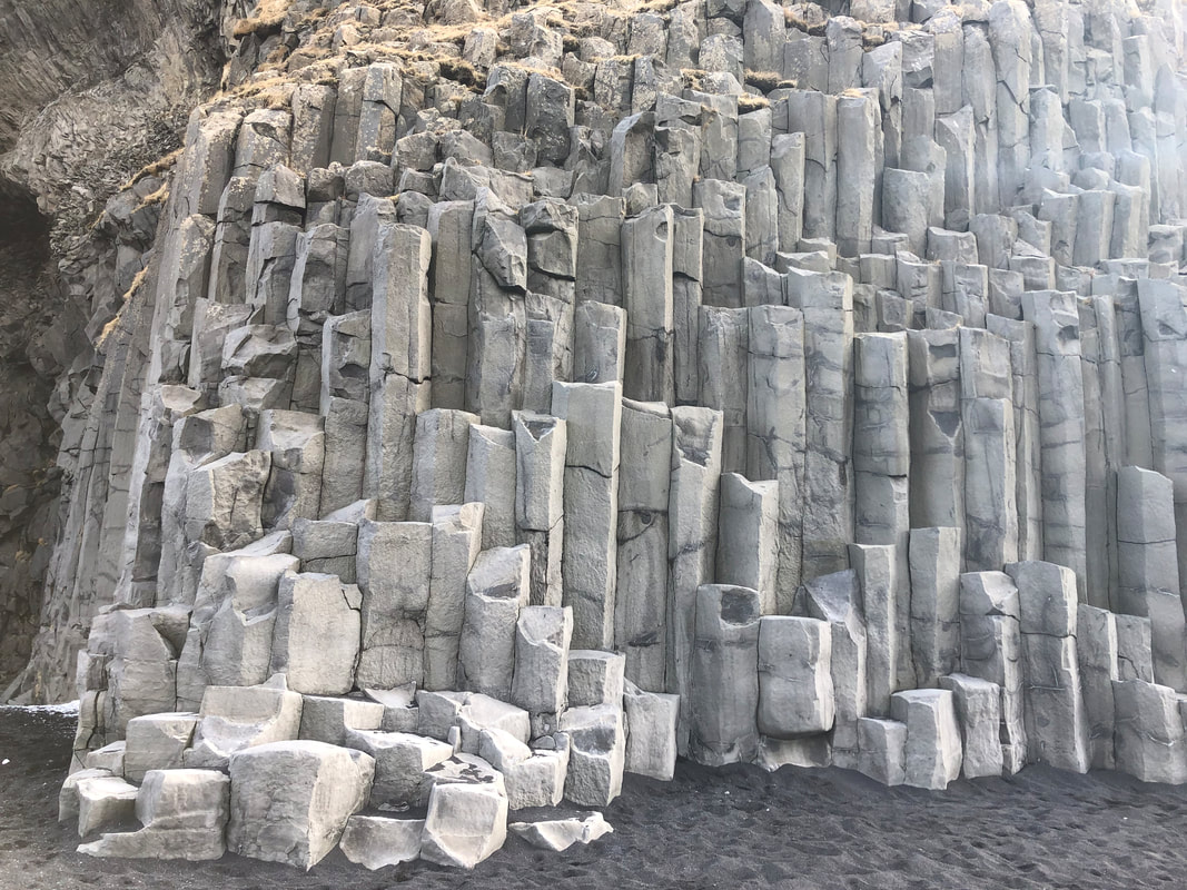
We drove back to Reynisfjara Beach and walked along the black sand. There are amazing rock columns formations on the large rock cliff along the beach. There is also a small cave to look at. The black stones on the beach are porous, volcanic stones and occasionally you can spot one that is distinctly red.
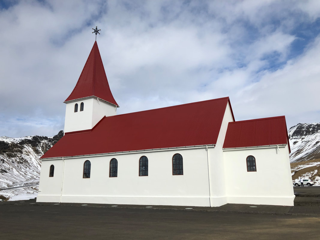
Driving through the small town of Vik, we headed up to the church on the top of the hill to see the view of the town and beach below. We spotted a few churches along our drive that had the same look- white buildings with peaked red roofs.
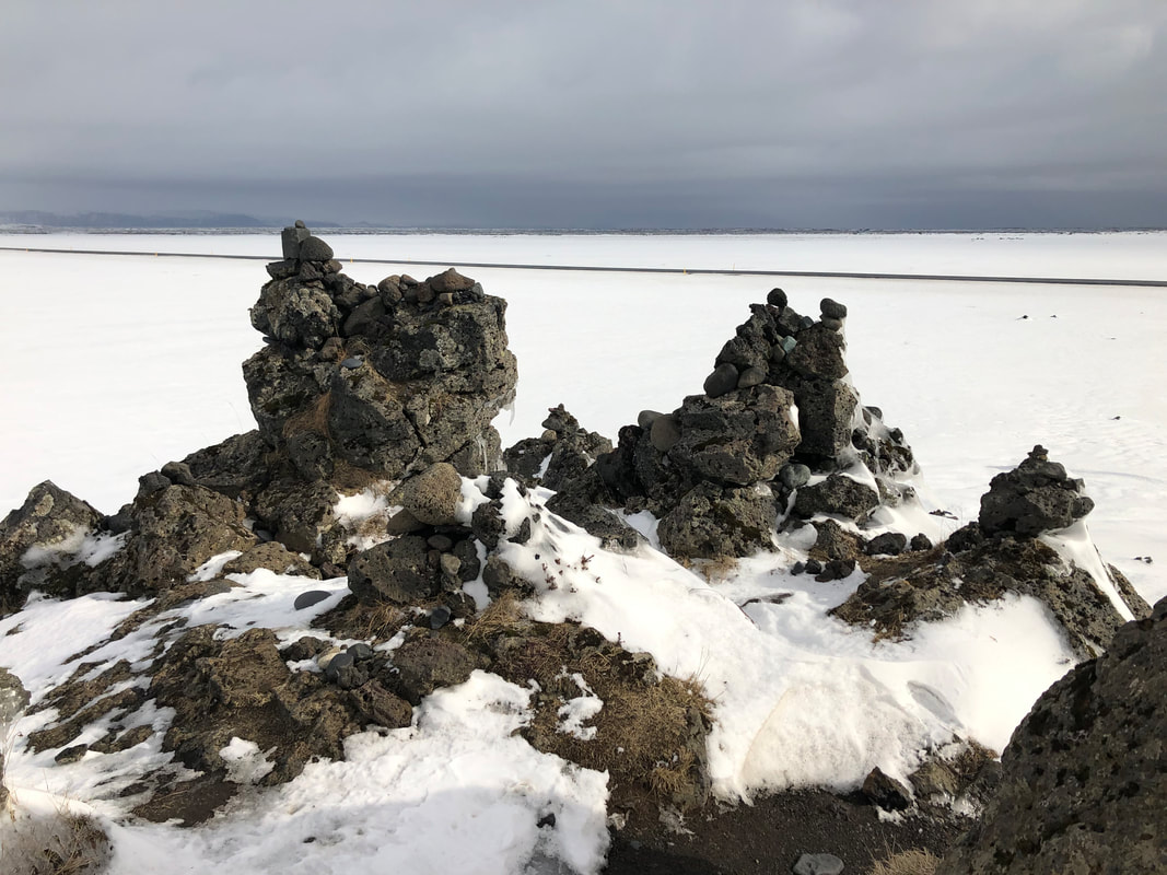
Our next stop was Laufskálavarða, a lava ridge that appeared to be in the middle of a snow field. All around it are stone cairns (stone piles), as it was said to bring good luck for travellers crossing the desert of Mýrdalssandur for the first time.
Our next stop was Laufskálavarða, a lava ridge that appeared to be in the middle of a snow field. All around it are stone cairns (stone piles), as it was said to bring good luck for travellers crossing the desert of Mýrdalssandur for the first time.
We were surprised by how few cars we passed on the south road between Vik and Hofn. The roads were very easy to navigate and well paved. Some of the smaller attractions do require you to drive short distances on dirt roads. There are a lot of one lane bridges which operate on a courtesy system (the car closest goes first and the other car waits), which made us wonder how busy they might get in the summer months.
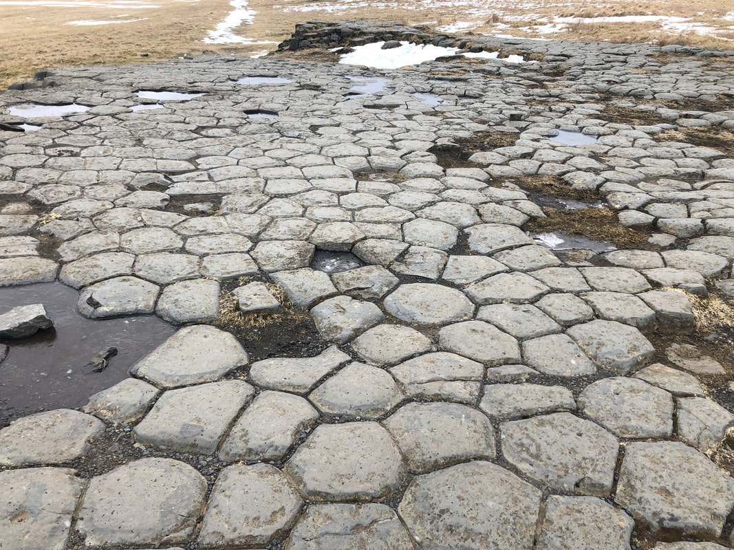
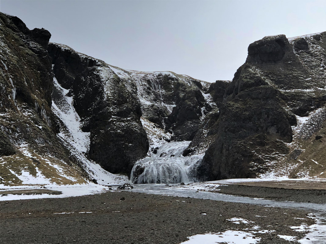
Our next stop was the area around Skaftárhreppur and was seemingly unvisited at the time. The Church Floor (Kirkjugólf) is an 80m² "floor" of eroded basalt stone columns. If you didn't know better, you would think this was a man-made tile floor. A few hundred meters down the road is the small waterfall Stjórnarfoss. The surrounding rock walls and river bed are lovely and you can walk along the river's edge.
Our next stop was the area around Skaftárhreppur and was seemingly unvisited at the time. The Church Floor (Kirkjugólf) is an 80m² "floor" of eroded basalt stone columns. If you didn't know better, you would think this was a man-made tile floor. A few hundred meters down the road is the small waterfall Stjórnarfoss. The surrounding rock walls and river bed are lovely and you can walk along the river's edge.
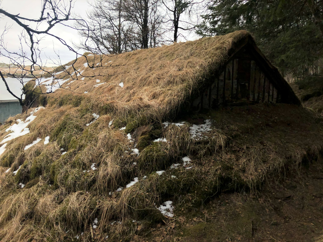
Heading back to the main roundabout and turning right, we headed to Systrafoss. The waterfall is a bit hard to see due to the rocks and trees in front of it but there is an interesting small turf building at the base. In the summer months the water flow is stronger, so it would be easier to see.
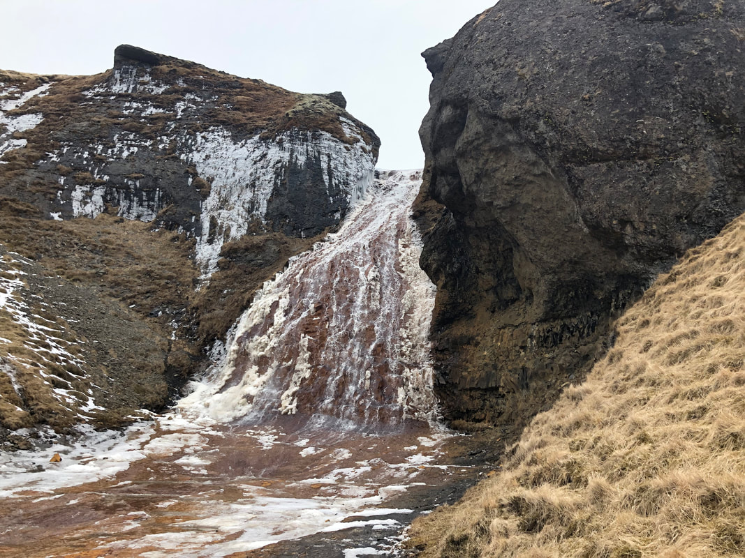
A bit further down the same road, we parked the car and walked a short hike to see Rauðárfoss and Systrastapi (Sisters) Rock. It is said that 2 nuns were buried at the top of this rock in the 14th century after being burnt at the stake for breaking their vows. The rock sits alone by the water's edge surrounded by green farm land. The colour behind Rauðárfoss waterfall appear almost red due to the iron in the soil.
A bit further down the same road, we parked the car and walked a short hike to see Rauðárfoss and Systrastapi (Sisters) Rock. It is said that 2 nuns were buried at the top of this rock in the 14th century after being burnt at the stake for breaking their vows. The rock sits alone by the water's edge surrounded by green farm land. The colour behind Rauðárfoss waterfall appear almost red due to the iron in the soil.
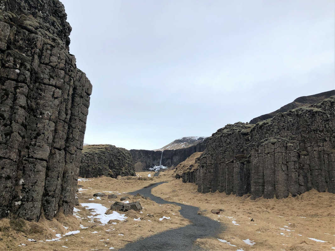
The Dverghamrar (The Dwarf Cliffs) are another incredible formation of rocks. The hexagonal columns seem to appear from nowhere in the middle of a field. According to folklore, the cliffs are home to both elves and dwarfs. There is a path that leads you through the middle of the two major rock formation and then back around to the parking lot so you can get a view from all sides.
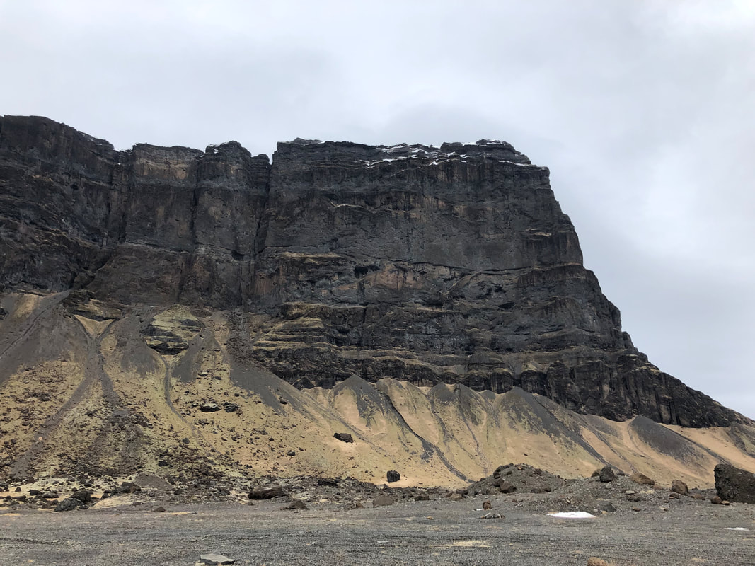
A short distance away, Lómagnúpur mountain looms 764m above the highway. There is a dirt road you can drive down to get closer and we think you can access the Núpsstaður turf houses via this route, but Tiny wasn't up for the adventure due to large, sharp stones on the path.
A short distance away, Lómagnúpur mountain looms 764m above the highway. There is a dirt road you can drive down to get closer and we think you can access the Núpsstaður turf houses via this route, but Tiny wasn't up for the adventure due to large, sharp stones on the path.
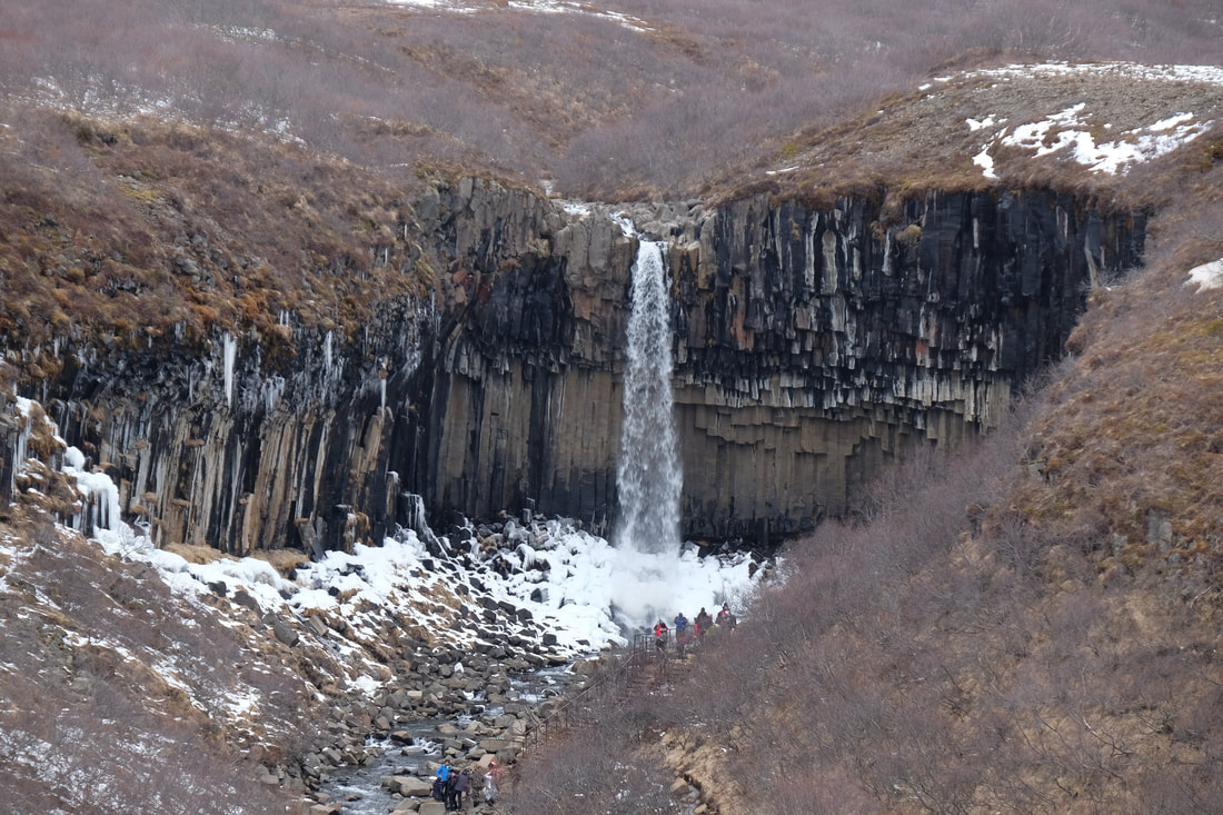
As we approached the Skaftafell nature reserve, we could see the blue coloured ice fields in the distance. We had a little bit of time so decided to make the 2km hike to Svartifoss waterfall. Along the path you pass another couple of waterfalls that probably don't get the attention they deserve. The rock surrounding Svartifoss is made up of the famous hexagonal pillars and was impressive even in winter when the water flow was lower.
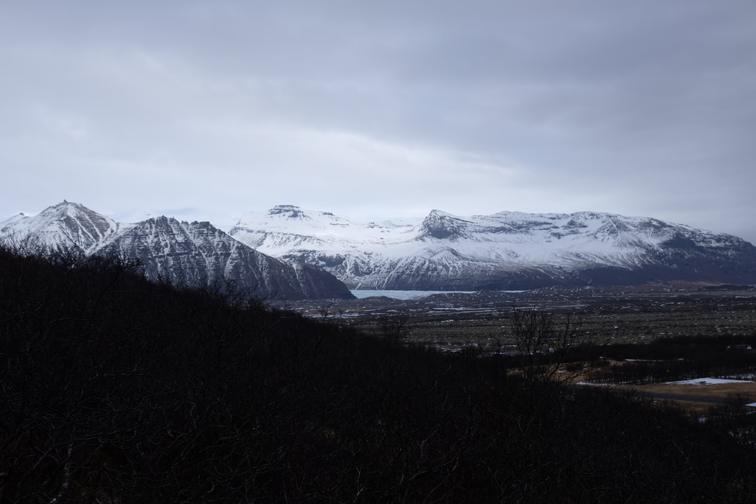
We could see the blue ice of the Skaftafellsjökull glacier area as we drove out of the reserve. This ice originates from Vatnajökull, Iceland's largest ice cap. We decided to keep driving to get closer to some of the blue ice ourselves.
We could see the blue ice of the Skaftafellsjökull glacier area as we drove out of the reserve. This ice originates from Vatnajökull, Iceland's largest ice cap. We decided to keep driving to get closer to some of the blue ice ourselves.
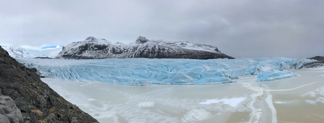
The unpaved, bumpy road to Svinafellsjokull glacier is only about 2.5km off the highway, but in our tiny car if took a LONG time to get to the end of the road (close to 30 minutes). But the view at the end was well worth the time. As you get out of the car, you can see a few blue glacier pieces floating in the water. As you walk closer, and follow the path to the left along the rocks, a full glacier field comes into view. The contrast of the water, the blue glacier ice, and the snowy mountain peaks was phenomenal. Definitely a highlight of the entire trip.
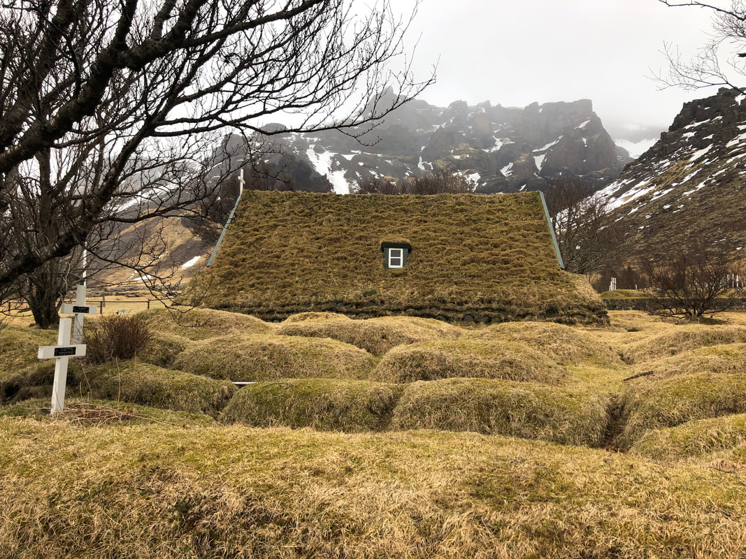
Our last two stops before Hofn were about 100km outside the city, in Hof. the first was Hofskirkja church, the last of the old churches built in the traditional turf style. There are records of a church being on this site for the past 700 years, although the core of the current church was built in 1883.
The second was a waterfall called Norafoss. It is a bit harder to find, but if you enter the driveway to the Fosshotel Glacier Lagoon you will see a small parking lot on the left. There is a small ladder through a gate in the fence and you will see the waterfall from the top of a small climb.
We arrived in Hofn before dark and had a quick look around the town. We even found a liquor store that had a few Icelandic craft beers. We stayed up monitoring the conditions for the Northern Lights, but after a quick drive out of town around 2am, we determined they weren't coming out that night and went to sleep.
DAY 3: Hofn-Folaldafoss-Hofn
Our third day was probably the easiest driving day. We had two nights booked at our accommodation in Hofn, so we knew we were coming back to where we started that morning. We decided to drive to Folaldafoss, 130km away and situated on the inland tip of the Berufjörður, before turning around and heading back to Hofn.
Our first stop, and where we spent a large portion of the morning, was Stokksnes peninsula. Here the Vestrahorn mountain peak towers 454m above the otherwise flat peninsula land. The black sand and small lagoon below contrast starkly with the towering, snow capped peaks.
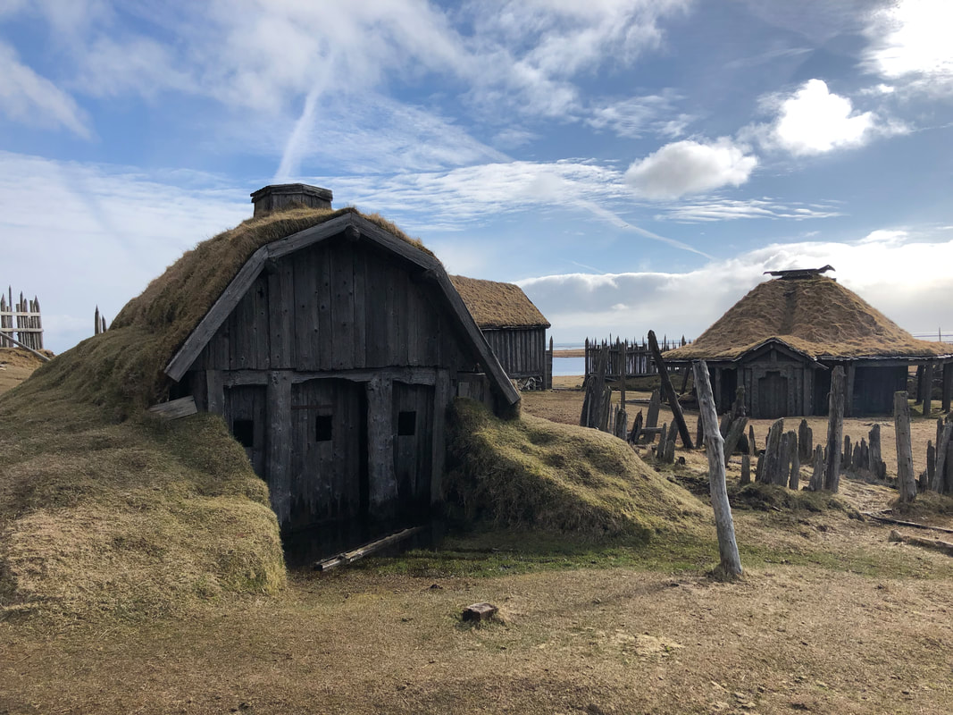
The peninsula is also the site of a viking village movie set. The Icelandic film was never shot, but you can explore the buildings within the wooden fence. Just follow the dirt road from the small cafe at the entrance.
In contrast to the black sand dunes and grassy fields, the coastline near the lighthouse is rocky and sharp. We even spotted a few fat seals sunning themselves on the rocks further off shore.
In contrast to the black sand dunes and grassy fields, the coastline near the lighthouse is rocky and sharp. We even spotted a few fat seals sunning themselves on the rocks further off shore.
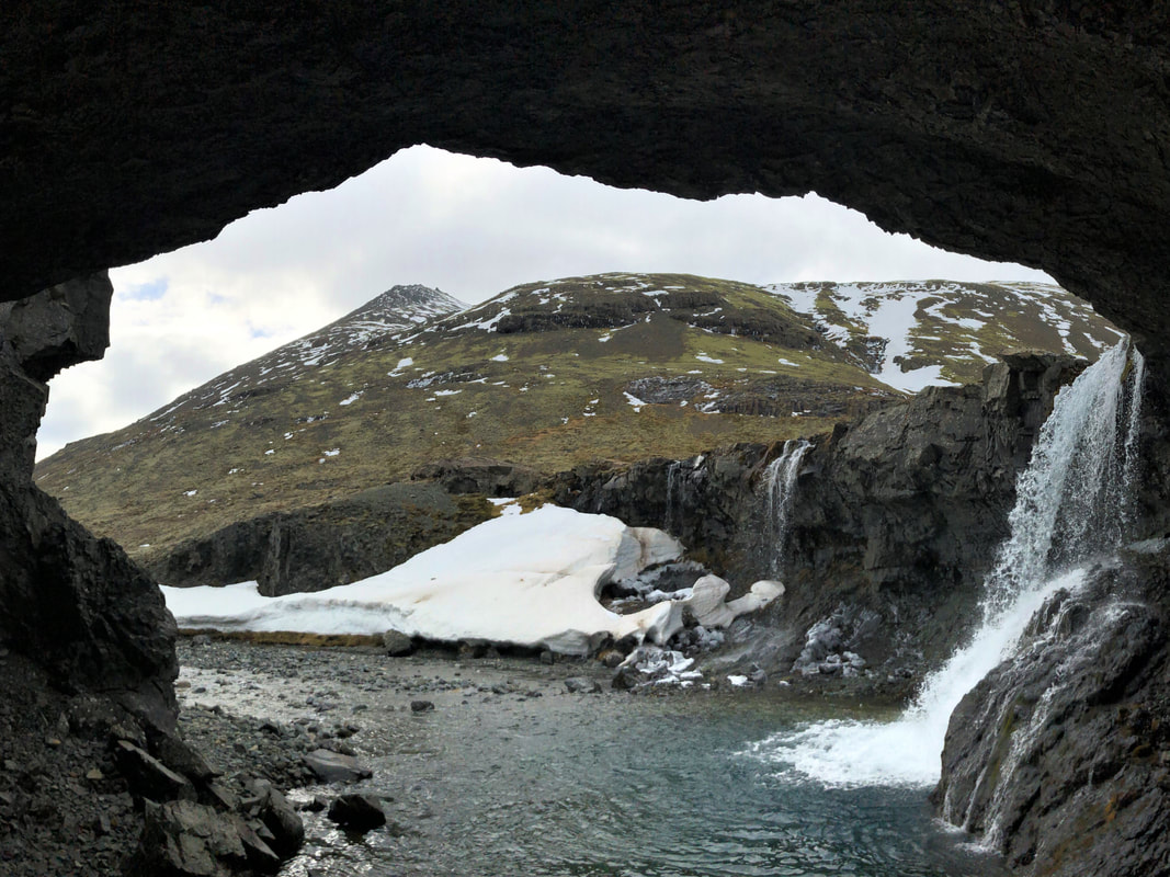
Skútafoss was our next destination, but after driving part way down the rocky dirt road we didn't want to risk getting the car stuck. We parked and walked the rest of the way down. There are two waterfalls along the same rock wall and all the way to the right there is a small cave. Make sure you walk up the path that takes you above the cave to see the waterfalls from above. There is also an amazing view of the valley above.
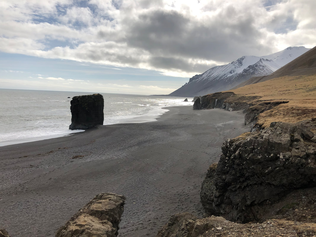
Driving along the southern coast, there are a few nice spots to stop and see the coastal terrain. There are also a few spots in this area that warn of sand storms, but thankfully at this time of year it wasn't an issue. One nice stop is the small beach near Stapi rock in Stapavík.
Driving along the southern coast, there are a few nice spots to stop and see the coastal terrain. There are also a few spots in this area that warn of sand storms, but thankfully at this time of year it wasn't an issue. One nice stop is the small beach near Stapi rock in Stapavík.
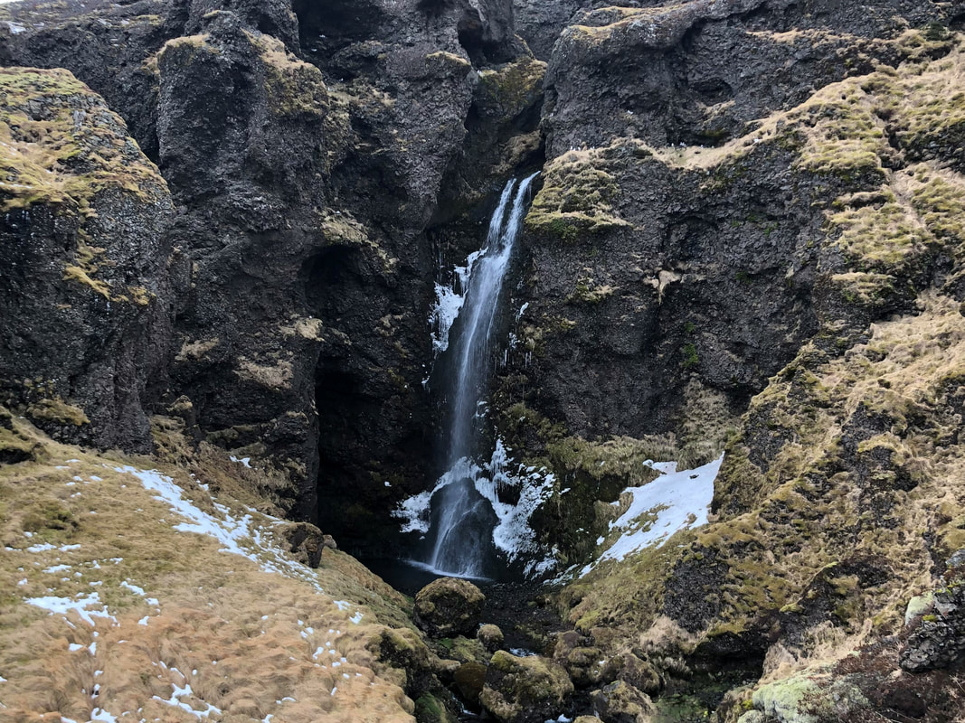
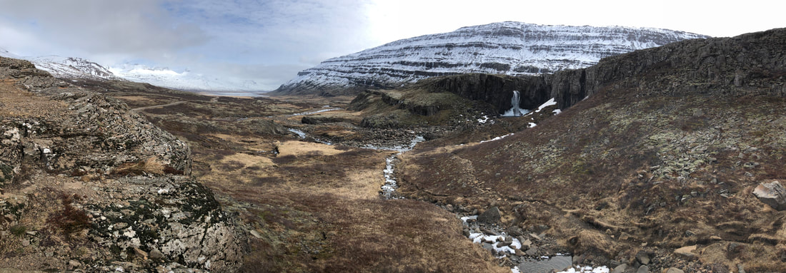
The road to Folaldafoss was actually marked with a sign saying the last 2km of the road to our furthest point was closed for the season. There was still an opening to drive down, so we decided to risk it and make the final distance. Just after the parking area for the waterfall viewpoint, the road was fully closed with a barricade so we took it as a sign that we had made it as far as we were going to. The base of the waterfall was still frozen but the panorama view was beautiful. We backtracked slightly to the smaller Nykurhylsfoss before starting our return journey to Hofn.
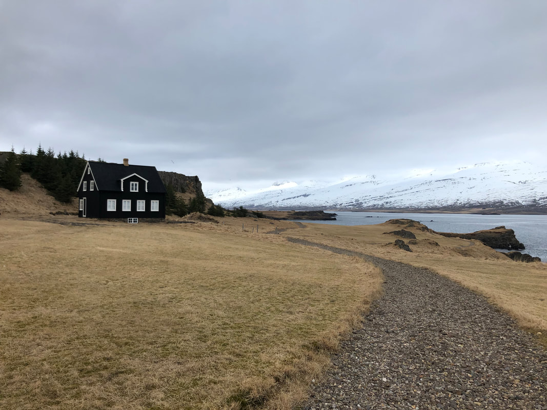
Along the coast you will spot a little black house, which is located on the Teigarhorn Natural Monument and Nature Preserve. The Weywadt house was built in 1880 and the farm area has a lovely coastal walk. It is also apparently one of the most renowned zeolite spots in the world. We didn't see any (in fairness, we didn't know what they were until we googled them afterwards) but there is meant to be a small museum with some on display. In case you don't know what a zeolite is either, it is a volcanic mineral that appears as white crystals.
We stopped in the harbour of Djúpivogur town to use the public toilet. Apparently the people of Iceland are very appreciative when tourists stop to use an actual toilet facility (there was even a sign saying thank you). I imagine that this must be an issue in the summer when tourism is at its peak, but we didn't pass many public restroom stops on our entire journey so mostly took advantage of petrol station facilities.
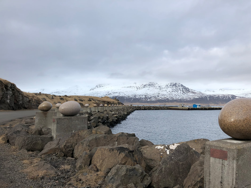
Along the coast near Djúpivogur, you will see some odd sculptures- the Eggs of Merry Bay (Eggin í Gleðivík). 34 large granite eggs balance on pillars that line the coastal road. The number 34 represents the different species of nesting birds in the area.
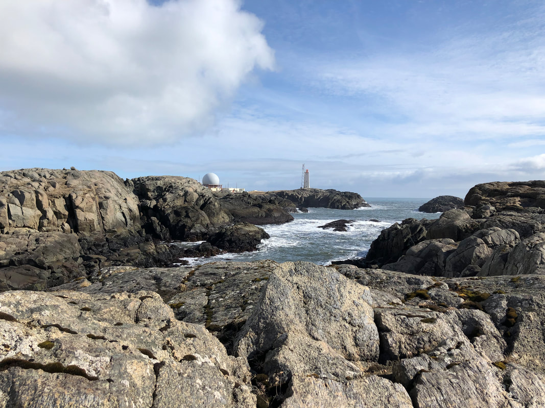
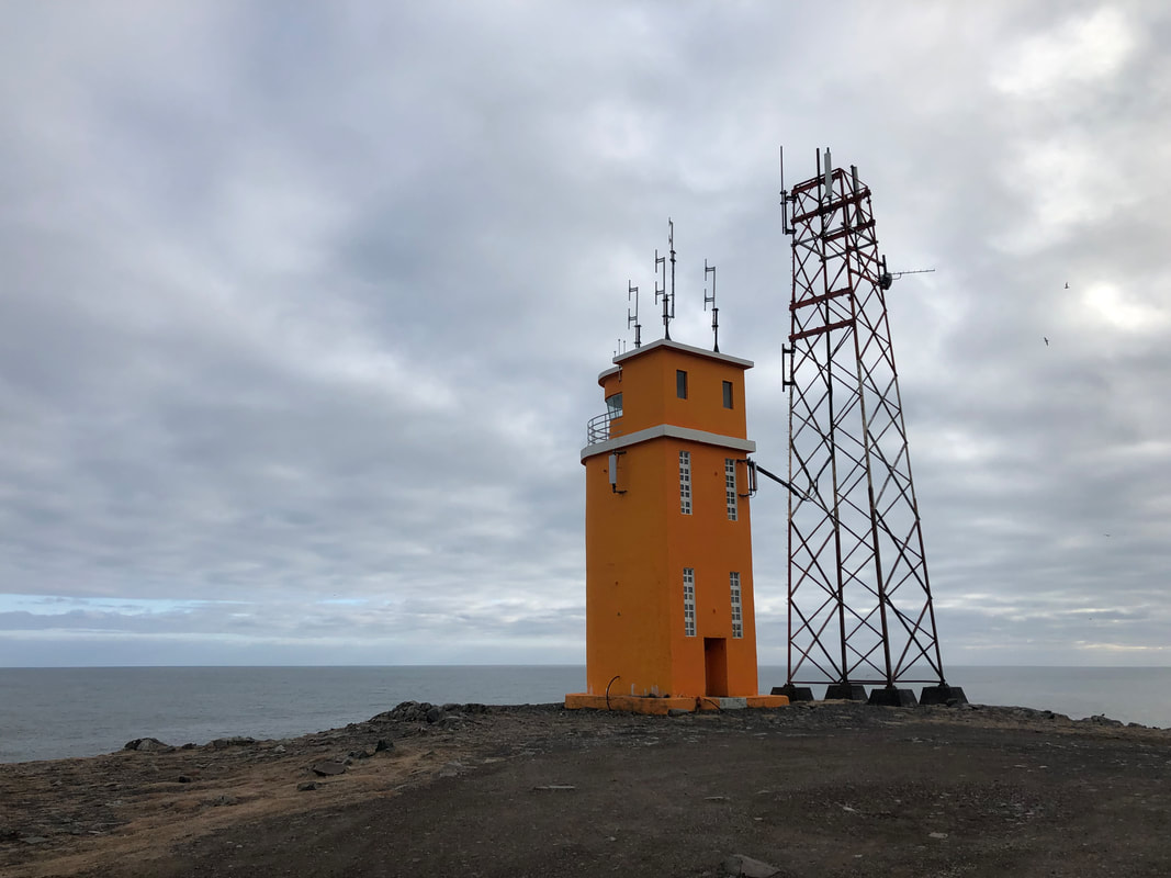
Back towards Hofn we stopped out on the point of the Hvalnes Lighthouse. The sky was starting to turn grey which made the location seem even more isolated and ominous. The bright orange concrete structure stands 11.5m high in sharp contrast and marks the Austerhorn cape on the southeastern corner Iceland.
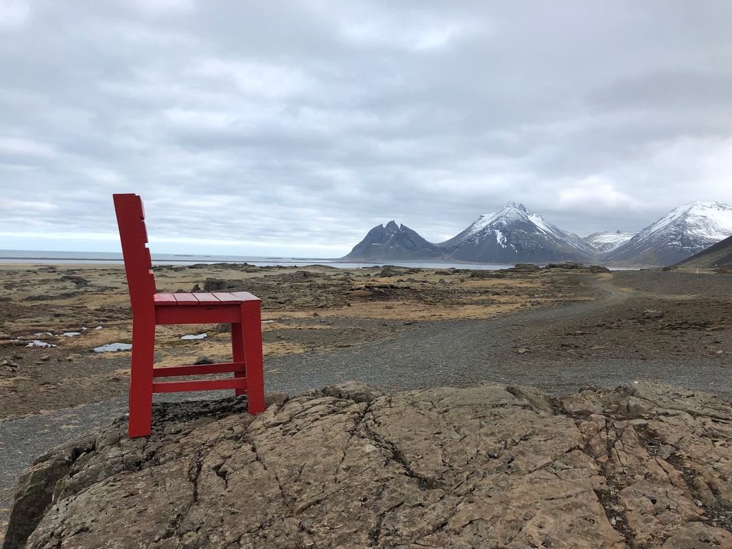
About 21km outside of Hofn, we spotted a random red chair on top a rock. The chair is actually secured to the rock with no explanation given. We took the opportunity for a few photos and then made our way back to Hofn for the night.
About 21km outside of Hofn, we spotted a random red chair on top a rock. The chair is actually secured to the rock with no explanation given. We took the opportunity for a few photos and then made our way back to Hofn for the night.
DAY 4: Hofn-Reykjavik-Reykjanesbær
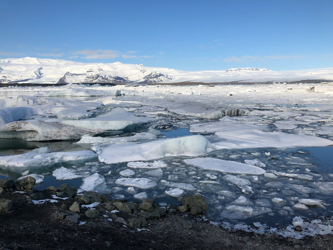
The sun was shining and the sky was bright blue on our last driving day. We had to make it the full distance back to the airport to catch an early morning flight the next day, so we had another big day ahead of us. We had briefly looked at the Glacier Lagoon on the way to Hofn, but the visibility was low due to snow. On this day the sky was clear and the pieces of ice floating in the lagoon were perfectly visible.
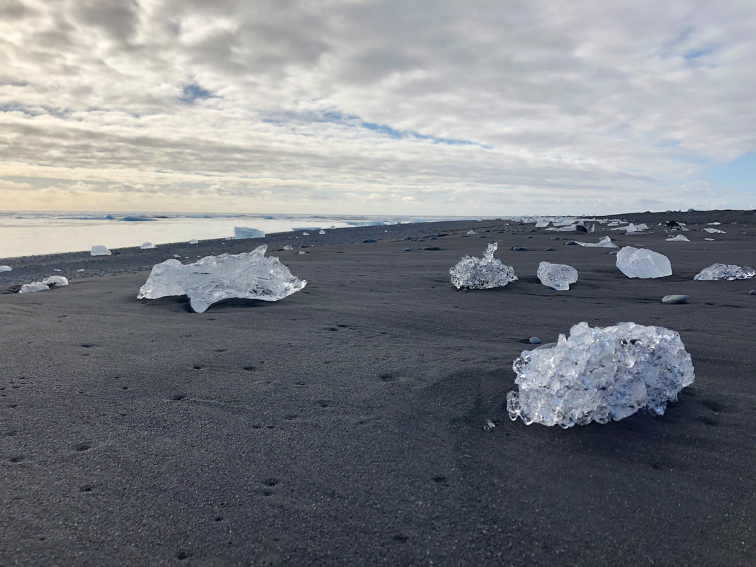
Just across the highway is Diamond Beach, where the pieces of ice washed up on the shore make it easy to see where the beach got its name. The ice glints in the sunlight on a background of black sand.
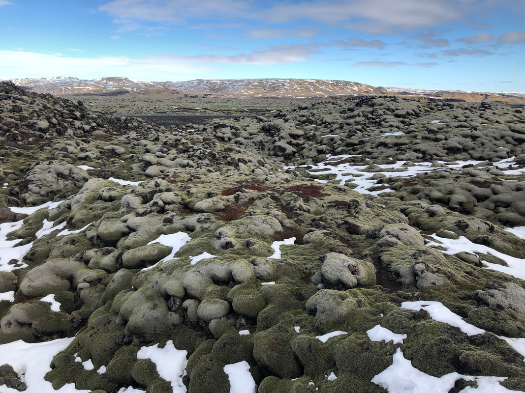
During the Skaftáreldar eruption, one of the largest eruptions in recorded history that lasted from 1783-1784, the Eldhraun lava field was created. This is now the location of the Green Lava Walk. The black lava rocks are now covered in thick green moss, which makes the landscape seem otherworldly. There is a small path marked out among the rocks so you can get up close to these bizarre formations.
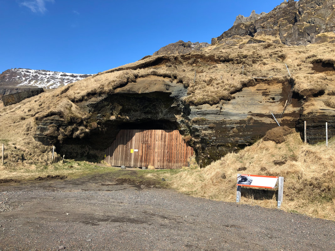
Another bizarre stop along the route back was the Steinahellir Cave. This cave is just beside the highway across from Holtsós lagoon, about 4km before the turn off to Ásólfsskáli when driving west. There is a wooden door and wall that blocks the entrance to the cave, but the door was unlocked when we visited. The cave was used as a sheep shed and hay barn in the past and also has several folklore stories associated with it. Inside the cave, the roof is covered with a carpet of ferns growing from the ceiling. It is said that anyone who touches the fern suffers bad luck. It has also been said that the crew from a shipwreck took refuge in the cave and died there, and still haunts the cave to this day.
Another bizarre stop along the route back was the Steinahellir Cave. This cave is just beside the highway across from Holtsós lagoon, about 4km before the turn off to Ásólfsskáli when driving west. There is a wooden door and wall that blocks the entrance to the cave, but the door was unlocked when we visited. The cave was used as a sheep shed and hay barn in the past and also has several folklore stories associated with it. Inside the cave, the roof is covered with a carpet of ferns growing from the ceiling. It is said that anyone who touches the fern suffers bad luck. It has also been said that the crew from a shipwreck took refuge in the cave and died there, and still haunts the cave to this day.
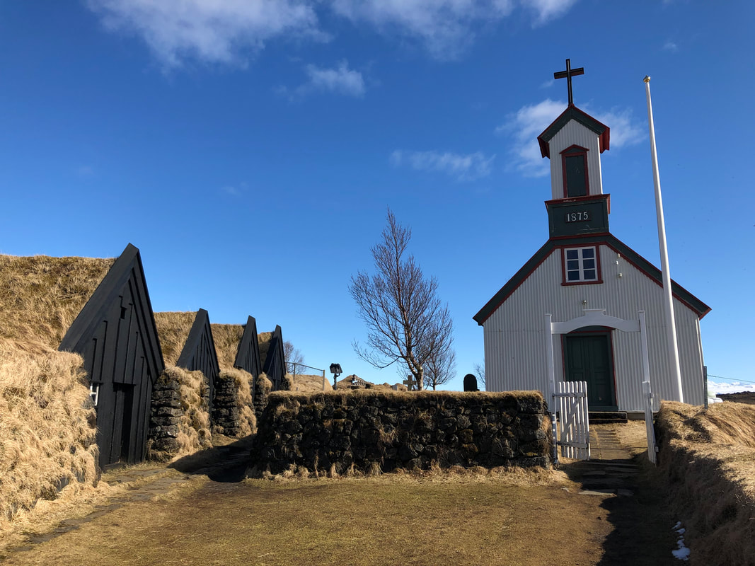
Our final stop before Reykjavik was the historical farm of Keldur. Keldur is one of the oldest preserved turf houses in south Iceland. The site is now a museum and was still closed for the season, but we were able to walk down the small path to have a look at the turf houses and the small chapel. The hall (skáli) is believed to be the oldest turf house hall in Iceland.
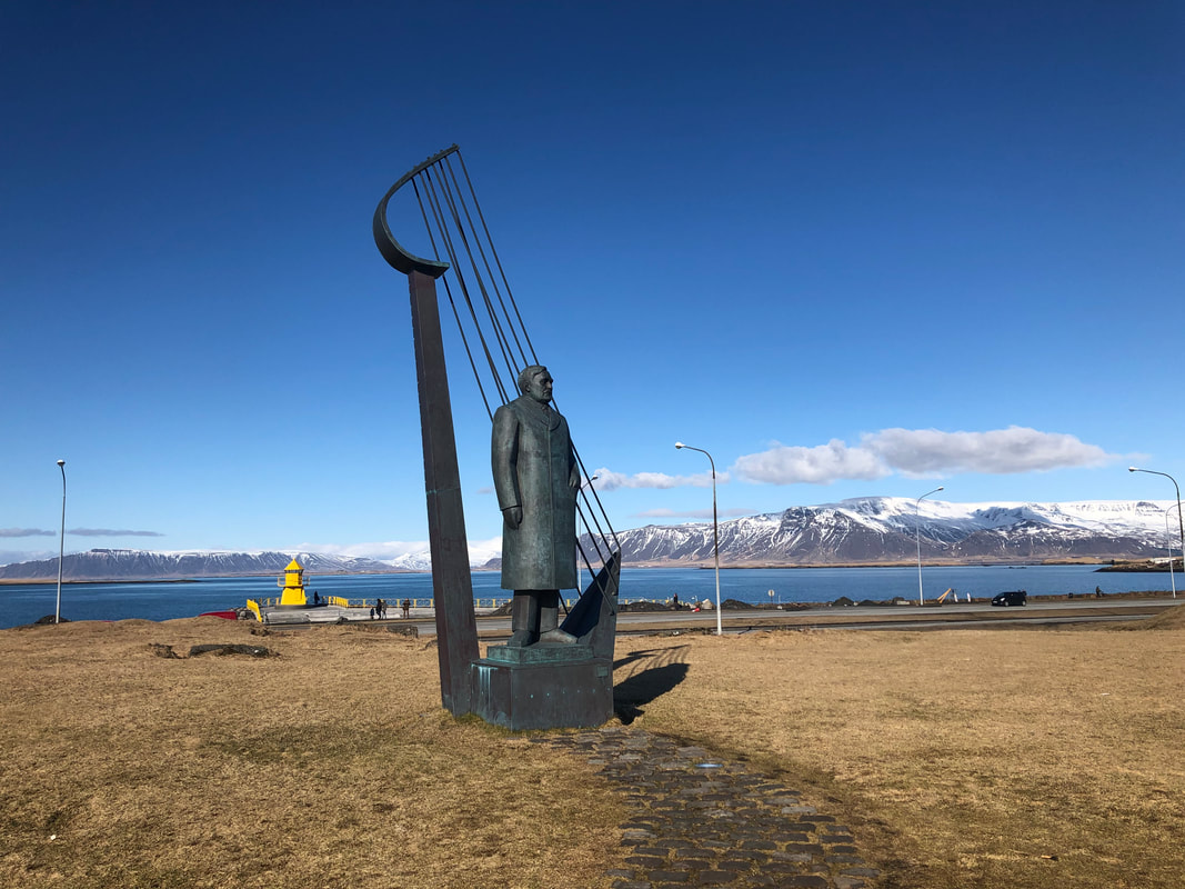
We drove into Reykjavik along the waterfront and stopped to see the Hofdi House, the Sun Voyages steel sculpture, and the Harpa Concert Hall. We drove along the water down around the Fiskislóð area and out through the Seltjarnarnes neighbourhood.
We drove into Reykjavik along the waterfront and stopped to see the Hofdi House, the Sun Voyages steel sculpture, and the Harpa Concert Hall. We drove along the water down around the Fiskislóð area and out through the Seltjarnarnes neighbourhood.
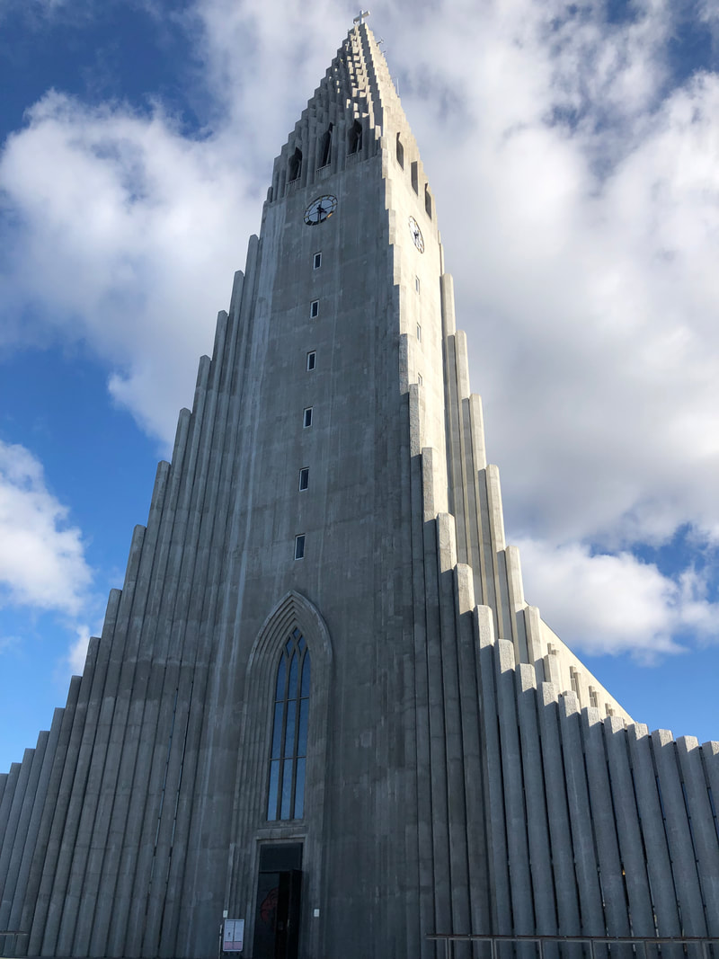
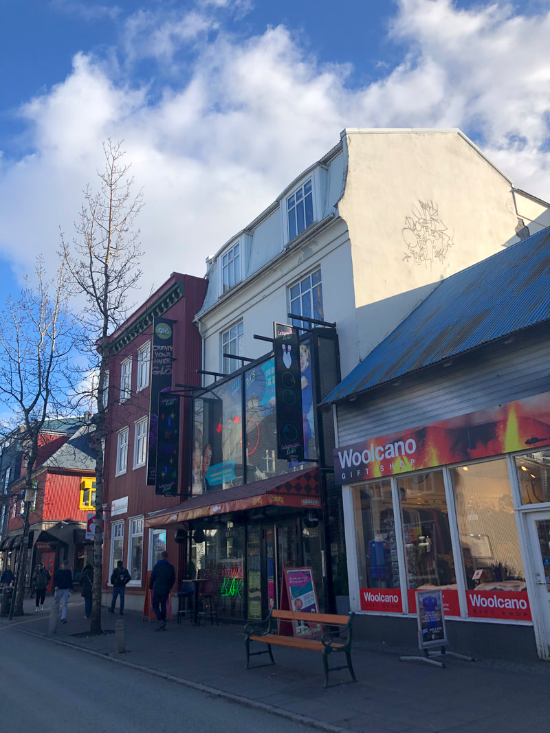
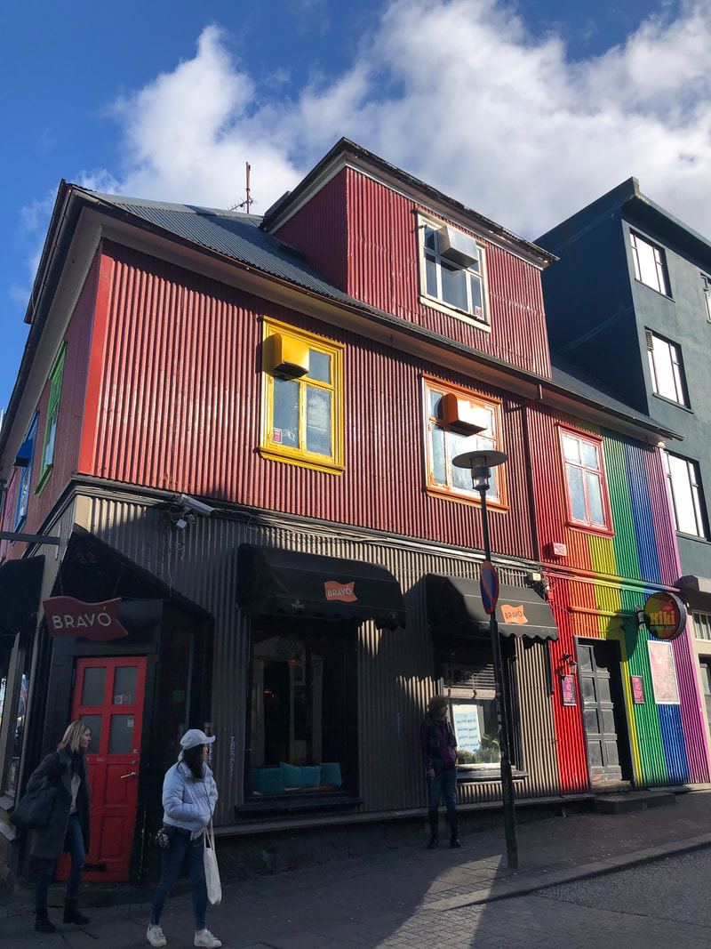
We drove up to the Hallgrímskirkja Church and parked in the parking lot. This church is the largest in Iceland and sits at the top of the main downtown shopping area. I didn't realize at the time, but the column structure of the church's facade mirrors the rock columns found in many of the natural rock formations around the country. We walked down through the main downtown area, exploring the small, colourful shops and streets.
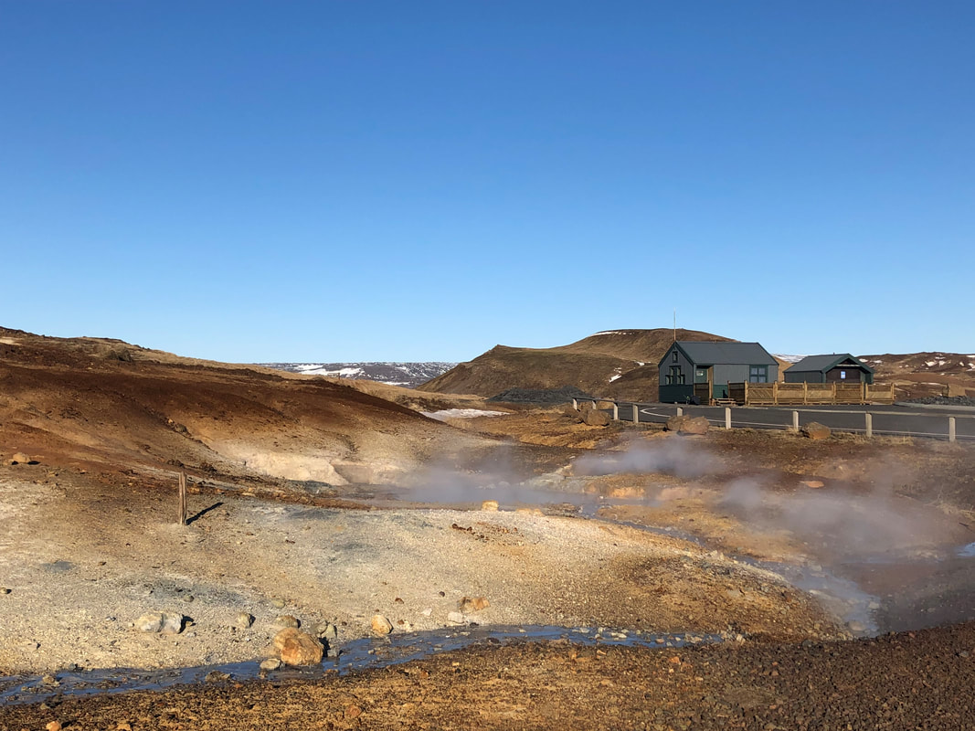
We had a 7pm reservation for the Blue Lagoon, so around 5pm we headed out of Reykjavik. The Krýsuvík geothermal pools are on route, so we stopped to look at the colourful landscape and see the geothermal pools bubbling and steaming.
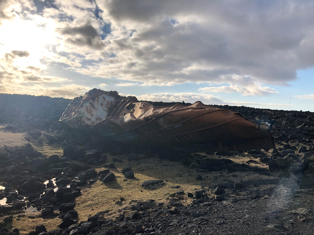
We also drove out to the point of Hópsnesviti lighthouse. The road is rough, but it is littered with old, washed up boats that have been rescued from the nearby waters in the past.
We also drove out to the point of Hópsnesviti lighthouse. The road is rough, but it is littered with old, washed up boats that have been rescued from the nearby waters in the past.
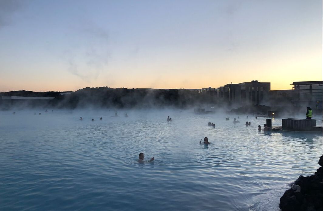
It seemed fitting that our final stop in Iceland be the Blue Lagoon Spa. We booked tickets in advance, as the time slots are limited and you are meant to arrive at your allocated time. As expected, the lagoon is quite touristy, but I was surprised at how large the site actually is. The waters are lovely and relaxing, but the social media photos you see don't really reflect the true experience. You first get to shower in a large room with a lot of other naked people, and then head out to the busy waters. Crowds of people are excitedly slathering on their free silicon face masks, so you can't help but laugh at the goopy, white faces that surround you. The masks are washed off in the lagoon waters, making you wonder if that's where the milky colour of the water actually comes from. Thankfully it was off season when we were there and we could occasionally find a quiet corner to relax.
For our final night, we stayed within 10 minutes of the airport, as we had an early morning flight booked to the UK. By the time we checked in, it was already dark and we were tired from a long few days. We asked the lady at reception what our chances were of seeing the Northern Lights and she said at this time of year it was more difficult and most tour companies had already stopped their tours for the year. We waited until almost 11pm and then decided to give it one last shot and drove out the highway towards Garður looking for a dark place to look at the sky.
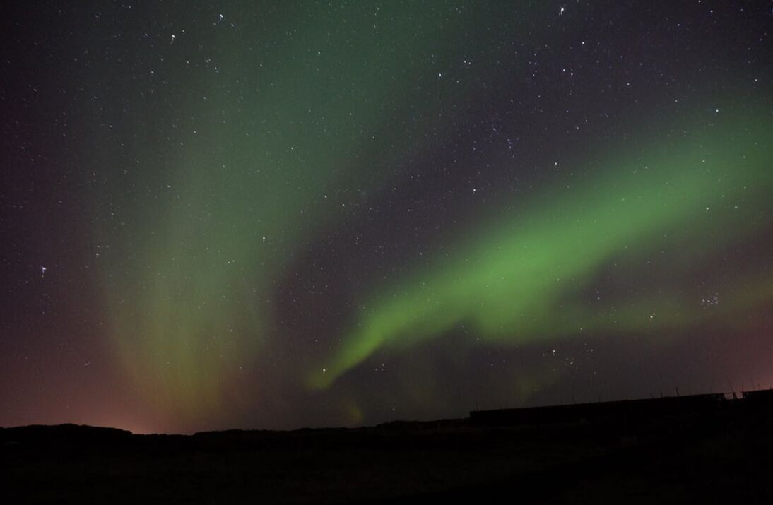
The first traces of the lights were very faint green, and it was hard to distinguish them due to road traffic and city lights. We tried another couple of spots before heading down a dark dirt road (probably onto someone's property). We sat in the dark, cold car waiting to see what Mother Nature had in store. As the green hues started to come out more strongly, I stood in the cold for nearly two hours, with my gloves off, the camera balanced on the hood of the car, on the lowest shutter speed, waiting 30 seconds for each photo to take. It was all worthwhile however, because on our last night in Iceland, we were able to see and capture the beauty of the Northern Lights.
After such a short visit, we only wished we had more time to complete to the loop and see the north. We had been worried about the cost of travelling the country, but with low cost accommodation, a cheap rental car, and (meatless) meals we cooked ourselves, it wasn't bad at all. (Oh- we also spent $20 on snacks in the dollar store in Toronto before we left. I reckon those easily saved us $100 in equivalent food from the Icelandic grocery stores.) Iceland is truly a spectacular, natural beauty. We hope to be back sometime to see more of it.
